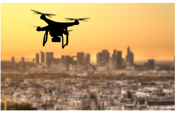
The drone market has taken the world by storm in the last few years. UAV technology is constantly developing, and drones are becoming more accessible to consumers and businesses alike.
In the commercial world, drones are being used to carry out land surveys and — in some cases — improve or automate business operations. The technology behind it all is LiDAR.
Drone LiDAR is more popular than it’s ever been before, and it’s a technology that’s continuing to gain traction. In 2018, the drone LiDAR market was valued at US$28.29 million, and that figure is predicted to rise to US$170.19 million by 2024.
So what is drone LiDAR, and why is it becoming increasingly popular? Here’s what you need to know about this technology, from the definition of UAV LiDAR, to how it’s used, and why the drone LiDAR industry is predicted to grow so quickly.
What is Drone LiDAR?
Drone LiDAR is a term that describes UAVs mounted with LiDAR (light detection and ranging) systems. LiDAR is a type of remote sensing that gathers information from the Earth’s surface or the surfaces of buildings and objects.
When mounted to a drone, a LiDAR system can survey land and cityscapes from the air. Using laser light pulses, the system can calculate specific 3D coordinates (also known as “points”) of the land. The system will collect millions of coordinates during a scan, and together these coordinates will make up a point cloud.
When uploaded to point cloud processing software, point clouds form a 3D, digital CAD model of the scanned environment. Much like a television screen has millions of pixels, millions of points make up a point cloud, giving surveying teams a clear picture of the scanned area.
With the resulting digital model, teams can analyze the condition, safety, and layout/location of roads, buildings, and structures. Data from drone LiDAR surveys helps analyze natural landscapes and topographical features.

Why Is Drone LiDAR Becoming More Popular?
In the past, LiDAR systems were mounted to static tripods, terrestrial (land-bound) vehicles, or in some cases, helicopters. But since drone LiDAR has become more accessible, it’s become the preferred method of surveying for many companies. So why is it so popular, compared to terrestrial or helicopter LiDAR?
Drone LiDAR comes with all the benefits of airborne lidar, without the hefty costs involved in helicopter-mounted LiDAR systems. UAV LiDAR systems can scan many miles of land in a short space of time. By scanning from above, surveying teams don’t have to worry about avoiding obstacles or disrupting busy areas, for example, with road closures. So for larger surveying projects, using a drone-mounted LiDAR system can be more cost-effective than alternative LiDAR solutions.
Drones can also reach and gather information from landscapes that other vehicles can’t reach. For example, drones often survey mines and unsafe building sites.
What Can UAV-Mounted LiDAR Systems Be Used For?
With a diverse range of potential applications, drone LiDAR is a technology that’s being adopted by organizations across many different industries. Here are some of the ways drone LiDAR is used around the world.
Creating Safe and Efficient Transport Routes
Transport agencies can use drone-mounted LiDAR to survey roads and railways. After processing the LiDAR data with point cloud processing software, agencies can analyze the condition of these transport corridors, identify safety risks, or rethink the efficiency of routes. By identifying areas of roads and railroads in need of maintenance, reconstruction, or relocation, transport agencies can ensure high-quality routes for the public.
Urban Planning Surveys
Drone LiDAR can survey large areas of land in a short space of time, which makes this technology perfect for urban planning projects. With projects often spanning a vast area, UAV LiDAR systems are one of the most efficient methods when it comes to gathering detailed information from the landscape.
The point cloud data gathered during drone LiDAR surveys can create a 3D digital model of the area in question. Geographical features and man-made structures can then be analyzed using this model, and with an advanced point cloud software, teams can simulate the construction of new buildings, and test structures and their layout.
Inspecting Unsafe Buildings and Mine Sites
Drones offer a much more agile alternative to larger LiDAR-carrying aircraft, such as helicopters. UAVs carrying LiDAR systems can reach areas that are off-limits to surveying teams due to limited accessibility or safety hazards. For example, buildings deemed unsafe, or mine sites can be surveyed with drone LiDAR, without teams having to face dangerous situations.
Enabling Precision Agriculture
Precision agriculture uses technology to improve the accuracy of farming. Agricultural businesses can use drone LiDAR to gather information from various fields and implement site-specific farming techniques. For example, drone LiDAR can detect signs of drought, identify different types and density of vegetation, and map fields. With more information about the land and by differentiating fields and vegetation, agricultural businesses can streamline processes by improving accuracy, productivity, and deliverables.
If you want to discover the potential of drone LiDAR, you’ll need to use an effective point cloud processing software to transform your LiDAR data into a 3D digital model. TopoDOT is offering a free demo of their point cloud software. So if your organization is looking to maximize revenue, you can start exploring the benefits of this software for free.